What is Borehole Geophysics?
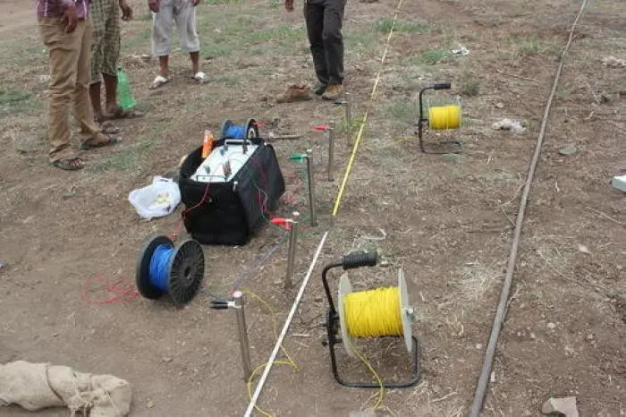
Borehole geophysics, often called well logging or geophysical logging, is the practice of making detailed physical measurements inside a borehole to characterise the surrounding geological formations. Unlike surface geophysics, which provides a broad overview, borehole logging delivers precise, depth‑specific data that reveals the lithology, porosity, permeability, fluid content, and structural features of the subsurface.
A logging tool—typically a slim instrument containing various sensors—is lowered into the borehole on a wireline cable. As it is raised at a controlled speed, it continuously records measurements, producing a series of logs (graphical representations) that are interpreted by experienced hydrogeologists.
In Kenya's diverse geology—which includes volcanic rocks, sedimentary basins, and weathered crystalline formations—borehole geophysics is an indispensable tool for ensuring successful well completion and optimal water production.
Why Formation Evaluation Matters
Formation evaluation is the process of using geophysical and geological data to understand the character and productivity of the subsurface. Without it, borehole drilling becomes a guessing game. Here is why it matters:
- Identifies productive zones – logs show exactly where water‑bearing fractures or porous formations occur, allowing the driller to target the most productive intervals.
- Guides casing and screen placement – knowing which zones produce water and which produce silt or clay helps determine where to place screens and where to seal the well.
- Detects low‑yield intervals – avoids wasting time and money on zones that will not contribute to the borehole's yield.
- Informs pump design – accurate depth and yield data ensure the pump is sized correctly for optimal efficiency and longevity.
- Supports regulatory compliance – the Water Resources Authority (WRA) and NEMA require detailed formation data for borehole permitting and approval.
In short, formation evaluation transforms drilling from an uncertain venture into a scientifically informed, predictable process that maximises the return on your investment.
Key Geophysical Logging Methods
Several geophysical logging methods are commonly used in borehole drilling. Each measures a different physical property, and together they provide a comprehensive picture of the formation.
| Logging Method | What It Measures | Primary Application |
|---|---|---|
| Resistivity Log | Electrical resistance of the formation | Identifies water‑saturated zones (low resistivity) and clay layers or dry rock (high resistivity). |
| Gamma Ray Log | Natural radioactivity (primarily from potassium, thorium, uranium) | Distinguishes shale/clay (high gamma) from clean sands and volcanic rocks (low gamma). |
| Spontaneous Potential (SP) Log | Natural electrical potential between the borehole and formation | Helps identify permeable zones and differentiate between sand and shale. |
| Caliper Log | Diameter of the borehole | Identifies washouts (enlarged sections), caverns, or squeezed zones; indicates unstable formations. |
| Temperature Log | Temperature of the fluid in the borehole | Detects water inflows (cooler zones) or fluid movement; geothermal gradients. |
| Fluid Flowmeter | Vertical movement of fluid in the borehole | Identifies productive zones by detecting flow entries; helps quantify production intervals. |
| Acoustic Televiewer (ATV) | Acoustic reflections from the borehole wall | Generates a high‑resolution image of the borehole wall, identifying fractures, bedding planes, and cavities. |
In practice, a combination of these logs is run to obtain a complete formation evaluation. For example, resistivity and gamma ray logs together provide robust lithology identification, while the caliper and ATV logs reveal structural details and borehole condition.
How Logging Guides Casing and Screen Placement
One of the most practical applications of borehole geophysics is determining the optimal placement of casing and screens. This is critical because a poorly designed completion can reduce yield, allow sand or silt intrusion, or cause the borehole to fail prematurely.
- Casing placement – logs identify stable, non‑productive zones where casing should be set. Casing isolates unstable formations, prevents collapse, and directs water flow from the screened intervals.
- Screen placement – productive zones identified by resistivity and flowmeter logs are targeted for screen placement. Screens are set across these intervals to allow water entry while filtering out fine particles.
- Gravel pack design – the grain size of the formation, inferred from resistivity and gamma ray logs, informs the selection of an appropriate gravel pack to maximise yield and minimise sand production.
- Sealing off poor zones – low‑yield or clay‑rich intervals identified by logs are sealed behind casing to prevent contamination and preserve the borehole's integrity.
In Kenya's variable geology—from the compact basalts of the Nairobi area to the weathered granites of the central highlands—this level of precision ensures that each borehole is tailored to its unique subsurface conditions.
Interpreting Geophysical Logs
Interpreting geophysical logs requires both experience and knowledge of the local geology. Here are some general principles:
- Resistivity increases with decreasing water content, increasing clay content, or increasing rock density. Clean, water‑saturated sands and fractured volcanic rocks show low resistivity, making them good potential aquifers.
- Gamma ray is high in shales and clay‑rich formations, and low in clean sandstones, limestones, and most volcanic rocks. A clean, low‑gamma interval with low resistivity is a strong indicator of a potential aquifer.
- SP deflection indicates permeability. A negative SP deflection often marks a permeable sand or fractured zone.
- Caliper variations larger than the bit size indicate washouts or caverns—areas where the formation is weak or fractured. These zones may require special attention during completion.
- Temperature anomalies can reveal groundwater inflow points. Colder water entering the borehole from deeper aquifers creates distinct temperature shifts in the log.
A professional hydrogeologist will integrate all available logs, compare them with drilling records and cutting samples, and produce a final interpretation that guides the completion and pump design.
How WaterLink Limited Uses Geophysical Logging
At WaterLink Limited, geophysical logging is an integral part of our standard drilling procedure. We believe that the investment in logging pays for itself many times over by ensuring a successful, high‑yield borehole.
- Modern digital logging suite – we deploy a comprehensive suite of downhole tools, including multi‑electrode resistivity, spectral gamma ray, SP, caliper, temperature, and acoustic televiewer.
- In‑house expertise – our team of certified hydrogeologists has decades of experience interpreting logs in Kenya's diverse geological settings, from the Rift Valley to the coastal aquifers.
- Real‑time decision making – logs are processed and interpreted on‑site, allowing us to make immediate decisions about casing depth, screen intervals, and gravel pack design without delay.
- Detailed final reports – each borehole is accompanied by a comprehensive geophysical report, including all logs, a detailed interpretation, and completion recommendations. This report supports WRA submissions and long‑term well management.
- Warranty and quality assurance – our reliance on rigorous formation evaluation is part of our commitment to delivering boreholes that perform as promised, backed by our comprehensive warranty.
By combining state‑of‑the‑art logging technology with deep local knowledge, we consistently achieve success rates above 95% across Kenya.
Common Pitfalls and How to Avoid Them
Despite the availability of advanced logging techniques, mistakes can still occur. Here are some common pitfalls and how to avoid them:
- Insufficient logging – running only one or two logs is rarely enough. A comprehensive suite of logs is essential for a reliable formation evaluation.
- Poor log quality – if the logging tool is not properly calibrated or the borehole fluid conditions are unsuitable, the data may be unreliable. Always use a reputable contractor with modern equipment.
- Over‑reliance on cuttings – drilling cuttings can be contaminated or mis‑identified. Geophysical logs provide a continuous, in‑situ record that is far more accurate than cuttings alone.
- Ignoring local geology – every region has unique geological characteristics. Logs must be interpreted with local knowledge to avoid misidentification of formations.
- Delaying decisions – waiting until after drilling to plan casing and screen placement can lead to suboptimal decisions. Logs should be interpreted immediately to guide completion in real time.
By following best practices and engaging experienced professionals, you can avoid these pitfalls and ensure your borehole delivers the water you need for decades to come.