Nairobi's Geological Setting: An Overview
Nairobi, the capital city of Kenya, sits on a unique geological foundation shaped by millions of years of volcanic activity. The city is situated on the eastern flank of the East African Rift System, a continental-scale rift zone that has been active for over 25 million years. This tectonic setting has produced a complex sequence of volcanic rocks that underlie the city and surrounding areas.
The geology of Nairobi is dominated by the Nairobi Volcanic Series, a thick succession of lava flows, pyroclastic deposits, and volcaniclastic sediments that cover an area of approximately 300 square kilometres. These volcanic rocks are primarily of Miocene to Pleistocene age (approximately 14 million to 0.5 million years old) and form the bedrock on which the city is built.
Key Fact: Nairobi's geology is part of the larger East African Rift volcanic province, which includes some of the most significant volcanic centres in Africa, including Mount Kenya, Mount Kilimanjaro, and the Aberdare Range. The city itself is built on a volcanic plateau that slopes gently from the Ngong Hills in the west to the Athi Plains in the east.
Understanding this geological context is essential for anyone planning to drill a borehole in Nairobi. The volcanic rocks control the occurrence and movement of groundwater, determine the drilling difficulty, and influence the water quality. In this guide, we will explore the geology of Nairobi in detail and explain how it affects borehole drilling and water supply.
The Nairobi Volcanic Series: Composition and Origin
The Nairobi Volcanic Series is a lithologically diverse sequence of volcanic rocks that records multiple episodes of volcanic activity. The main rock types encountered in the series include:
- Basalts — Dark-coloured, fine-grained volcanic rocks formed from relatively low-viscosity lava flows. Basalts are the most common rock type in the series and form the bulk of the volcanic pile.
- Trachytes — Light-coloured, intermediate volcanic rocks with a higher silica content than basalts. Trachytes are often associated with more explosive volcanic activity and can contain large crystals of feldspar.
- Phonolites — A silica-undersaturated volcanic rock with a distinctive composition that includes feldspathoid minerals such as nepheline. Phonolites are common in the Nairobi area and are often associated with the formation of volcanic domes.
- Tuffs and pyroclastics — Fragmental volcanic deposits formed from explosive eruptions. These include ash, pumice, and volcanic bombs that have been consolidated into rock. Tuffs can be soft and easily eroded, or well-cemented and hard.
- Volcaniclastic sediments — Sedimentary deposits derived from the erosion and redeposition of volcanic materials, often found in valleys and basins.
The volcanic activity that created these rocks occurred in several phases, each producing different rock types. The earliest volcanism, approximately 14 million years ago, produced extensive basalt flows. Later activity, around 8–10 million years ago, resulted in the eruption of trachytes and phonolites. The most recent volcanic activity, about 0.5 million years ago, produced the pyroclastic deposits that cap the volcanic sequence in some areas.
| Rock Type | Colour | Hardness | Fracturing | Water-Bearing Potential |
|---|---|---|---|---|
| Basalt | Dark grey to black | Very hard | Moderate to high (joints and cooling fractures) | Good (fracture-controlled) |
| Trachyte | Light grey to pinkish | Hard | Moderate | Moderate |
| Phonolite | Grey to greenish | Very hard | Low to moderate | Fair to good |
| Tuff | Variable (yellow, brown, grey) | Soft to moderately hard | Variable | Variable (can be good if porous) |
| Volcaniclastic Sediments | Brownish to grey | Soft to moderate | Not applicable | Good (primary porosity) |
The distribution of these rock types across Nairobi is not uniform. Different areas are underlain by different combinations of these rocks, which affects the drilling difficulty and the groundwater potential. For example, areas in the western part of the city, such as Lang'ata and Karen, are often underlain by thicker sequences of trachytes and phonolites, while the eastern parts, such as Embakasi and Ruai, may have more basalts and volcaniclastics.
How Groundwater Occurs in Volcanic Rocks
Groundwater in volcanic rocks is fundamentally different from groundwater in sedimentary rocks. The primary porosity (the pore spaces between grains) of volcanic rocks is extremely low—typically less than 1%. This means that volcanic rocks cannot store significant amounts of water in their matrix like sandstones or limestones can. Instead, groundwater in volcanic rocks is stored and transmitted through secondary permeability.
Secondary permeability in volcanic rocks is created by:
- Fractures and joints — As volcanic rocks cool, they develop cooling joints (columnar jointing in basalts) and tectonic fractures from earth movements. These fractures provide pathways for water flow.
- Weathering — Chemical and physical weathering breaks down the rock, creating weathered zones that can store water and transmit it more easily.
- Fault zones — Faults are zones of weakness where rock has been fractured and broken, often creating high-permeability zones that concentrate groundwater flow.
- Weathered contacts — The contact between different volcanic rock types (e.g., between a basalt flow and a tuff) can be a zone of weakness that weathers more readily, creating a water-bearing horizon.
Hydrogeological Principle: In volcanic terrains, groundwater is not uniformly distributed. It is concentrated in zones of high fracturing, weathering, or faulting. The success of a borehole depends on intersecting one or more of these productive zones.
The water table in Nairobi's volcanic rocks is typically found at depths ranging from 20 to 80 metres below the surface, depending on the topography and the season. However, the most productive water-bearing zones are often at greater depths—between 80 and 200 metres—where fracturing is more intense and the weathering is deeper.
The movement of groundwater through volcanic rocks is generally slow and tortuous, following the complex network of fractures. This means that boreholes in volcanic terrains often have low to moderate yields compared to sedimentary aquifers, but the water quality is often excellent due to the natural filtration provided by the rock matrix.
Aquifer Types in Nairobi's Volcanic Terrain
Based on the geological setting, several types of aquifers can be identified in Nairobi's volcanic terrain:
| Aquifer Type | Description | Typical Depth (m) | Yield Potential | Common Locations |
|---|---|---|---|---|
| Weathered Zone Aquifer | Water stored in the weathered and fractured upper part of the volcanic sequence | 20 – 80 | Low to moderate (5–50 m³/d) | Valley floors, hill slopes |
| Fracture Aquifer | Water stored in interconnected fractures and joints at depth | 80 – 200 | Moderate to high (50–300 m³/d) | Most of Nairobi; especially along fault zones |
| Fault Zone Aquifer | High-permeability zones along fault lines with intense fracturing | 100 – 250 | High (200–600 m³/d) | Areas near major faults (e.g., Ngong Fault) |
| Volcaniclastic Aquifer | Water stored in the primary porosity of volcaniclastic sediments | 30 – 100 | Moderate (30–100 m³/d) | Valley fills, basin deposits |
| Contact Aquifer | Water stored along the contact between different volcanic rock types | 60 – 150 | Moderate (20–80 m³/d) | Boundaries between basalt and tuff, etc. |
The most productive boreholes in Nairobi are typically those that intersect a fracture aquifer or a fault zone aquifer. These aquifers can yield 200–600 m³/d, which is sufficient for commercial and high-demand residential use. However, locating these productive zones requires detailed geological and geophysical investigation.
WaterLink Insight: Our experience has shown that fracture aquifers in Nairobi are often associated with specific geological structures, such as the intersections of joint sets or the weathered contacts between different lava flows. Our geologists use detailed mapping and resistivity surveys to target these structures.
Drilling Challenges in Volcanic Formations
Drilling in Nairobi's volcanic formations presents several significant challenges that require specialised equipment and expertise:
- Hard and abrasive rocks — Basalts, trachytes, and phonolites are extremely hard and abrasive, causing rapid wear on drill bits. Diamond drill bits and DTH (Down-The-Hole) hammers are required to penetrate these rocks efficiently.
- Variable rock hardness — The volcanic sequence can vary from soft, weathered tuffs to extremely hard, fresh basalt within a short vertical distance. This variability requires careful drilling parameter management.
- Loss of circulation — When the drill penetrates a highly fractured zone or an open fracture, drilling fluid can be lost into the formation, reducing the efficiency of the drilling process and increasing costs.
- Water strikes — Sudden inflow of water from a fracture can surge into the borehole, potentially causing stability issues and complicating the drilling operation.
- Borehole stability — In weathered or poorly cemented volcanic rocks, the borehole walls may collapse, requiring careful casing and grouting.
- Depth variability — The depth to productive zones can vary significantly over short distances. A borehole drilled 50 metres away from a successful borehole may encounter completely different geology and may not be productive.
- High energy requirements — Drilling through hard volcanic rocks requires high-power equipment and high-pressure air compressors, increasing the cost of drilling.
These challenges mean that borehole drilling in Nairobi is not a simple task. It requires a combination of geological knowledge, modern drilling equipment, and experienced personnel to achieve a successful outcome. This is why choosing a contractor with local expertise is essential.
| Challenge | Impact on Drilling | Mitigation Strategy |
|---|---|---|
| Hard rock (basalt, phonolite) | Slow penetration, high bit wear, increased time and cost | Use DTH hammers with tungsten carbide bits; adjust air pressure and rotation speed |
| Loss of circulation | Fluid loss, potential borehole instability | Use lost circulation materials (LCM) or switch to air drilling in fractured zones |
| Variable rock hardness | Uneven drilling progress; bit damage | Monitor drilling parameters and adjust as needed; use hybrid drilling techniques |
| Water strikes | Sudden inflow, potential equipment damage | Anticipate from geological data; control flow with casing or packers |
| Borehole instability | Collapse, stuck drill string | Install casing in unstable zones; use appropriate drilling mud |
Key Factors for Borehole Success in Nairobi
Despite the challenges, thousands of successful boreholes have been drilled in Nairobi. The key factors that contribute to success are:
- Thorough geological investigation — Before drilling, a detailed geological survey, including resistivity profiling and electromagnetic surveys, helps identify potential water-bearing structures.
- Understanding fracture patterns — Knowledge of the regional and local fracture patterns allows the driller to target areas where fractures are likely to be more abundant and interconnected.
- Optimal drilling location — Choosing the right location on a property—often near fault lines, valley axes, or intersections of joint sets—significantly increases the chances of intersecting water.
- Appropriate drilling technology — Using DTH hammers with high-pressure compressors is essential for penetrating hard volcanic rocks efficiently.
- Experience and expertise — Drillers who have worked extensively in Nairobi's volcanic formations know what to expect and how to adapt to changing conditions.
- Proper well design — The borehole must be designed with appropriate casing, screen, and filter pack to maintain long-term productivity and prevent sand production.
- Adequate development — Thorough well development after drilling ensures that the fractures are clean and the water flows freely, maximising the yield.
WaterLink Success Formula: Our 98% success rate in Nairobi is built on decades of experience, comprehensive geological assessment, modern drilling equipment, and meticulous well design. We don't guess—we use science and data to guide every borehole project.
Borehole Depth and Yield: What to Expect
The depth and yield of boreholes in Nairobi vary considerably depending on the location and the geological structure encountered. Here is what you can generally expect:
| Area / Suburb | Typical Depth Range (m) | Typical Yield Range (m³/d) | Geological Notes |
|---|---|---|---|
| Karen | 180 – 280 | 80 – 300 | Thick trachytic-phonolitic sequence; deep fractures |
| Runda / Kitisuru | 150 – 250 | 100 – 350 | Similar to Karen; productive fracture zones |
| Lavington / Kilimani | 150 – 220 | 80 – 250 | Moderate depth; mixed volcanics |
| Westlands / Parklands | 140 – 200 | 70 – 200 | Shallower aquifers; urban constraints |
| Embakasi / Ruai | 120 – 180 | 50 – 150 | More basaltic; weathered zones shallower |
| Lang'ata | 160 – 240 | 80 – 220 | Similar to Karen; deep fracturing |
| Ruiru / Kiambu Road | 120 – 220 | 70 – 200 | Variable; both volcanic and sedimentary |
Important Note: These are average values based on our extensive database. Individual boreholes within the same area can vary significantly depending on the specific geological structure encountered. A borehole in Karen could yield 300 m³/d if it intersects a major fracture zone, or it could yield only 50 m³/d if it misses the fractures.
The yield of a borehole (the volume of water it can produce per day) is typically determined by the transmissivity of the fractures and the drawdown during pumping. In general, boreholes in Nairobi's volcanic formations produce between 50 and 300 m³/d, with some exceptional boreholes exceeding 500 m³/d.
The Role of Geophysical Surveys
Geophysical surveys are essential for successful borehole drilling in Nairobi's volcanic terrain. They help to:
- Identify the depth to bedrock and the thickness of the weathered zone
- Map the distribution of different volcanic rock types
- Locate fractures, fault zones, and other structures that may contain water
- Determine the best location for drilling
- Estimate the depth to the water table
The most common geophysical methods used in Nairobi are:
- Electrical Resistivity Survey — This method measures the electrical resistance of the ground. Water-bearing fractures and weathered zones have lower resistivity than solid rock, making them detectable.
- Electromagnetic (EM) Survey — EM methods measure the conductivity of the subsurface. They are particularly effective for mapping fracture zones and identifying areas of high groundwater potential.
- Ground Penetrating Radar (GPR) — GPR uses radar waves to image the subsurface. It is useful for identifying shallow fractures and geological structures.
- Seismic Refraction — This method measures the velocity of seismic waves through the ground. It can be used to identify rock types and the depth to the water table.
WaterLink Practice: We combine electrical resistivity surveys with detailed geological mapping to identify the most promising drilling locations. Our geophysicists have extensive experience interpreting the complex volcanic geology of Nairobi.
The cost of a geophysical survey typically ranges from KES 50,000 to KES 100,000, depending on the area and the method used. This is a small investment compared to the cost of a failed borehole, which can exceed KES 1,000,000. We strongly recommend that all borehole projects in Nairobi be preceded by a geophysical survey.
Water Quality in Nairobi's Groundwater
The quality of groundwater in Nairobi's volcanic aquifers is generally good to excellent, thanks to the natural filtration provided by the volcanic rocks. However, some quality issues can occur:
- Hardness — Nairobi's groundwater is typically moderately hard to hard, with calcium carbonate concentrations ranging from 100 to 300 mg/L as CaCO₃. This is not a health concern but may require a water softener for domestic use.
- Iron and Manganese — In some areas, especially where the groundwater interacts with weathered volcanic rocks, elevated levels of iron (Fe) and manganese (Mn) can occur. These can cause staining and taste issues.
- Fluoride — Some volcanic rocks contain fluoride-bearing minerals, and groundwater in certain areas can have elevated fluoride concentrations (above 1.5 mg/L). This is a health concern and may require treatment.
- Nitrates — In urban areas, nitrate contamination can occur from sewage infiltration or agricultural runoff. However, this is less common in deep boreholes.
- Microbiological Quality — Deep boreholes (below 80 metres) are generally free from surface contamination and have good microbiological quality. Shallow boreholes may be more vulnerable to contamination.
| Parameter | Typical Range | WHO Guideline | Treatment Required? |
|---|---|---|---|
| pH | 6.5 – 8.0 | 6.5 – 8.5 | Usually not |
| Total Hardness (CaCO₃) | 100 – 300 mg/L | No guideline | Optional (water softener recommended for high hardness) |
| Iron (Fe) | 0.1 – 5.0 mg/L | 0.3 mg/L | Yes, if > 0.3 mg/L |
| Manganese (Mn) | 0.02 – 1.0 mg/L | 0.1 mg/L | Yes, if > 0.1 mg/L |
| Fluoride (F) | 0.5 – 3.0 mg/L | 1.5 mg/L | Yes, if > 1.5 mg/L |
| Nitrate (NO₃) | 5 – 50 mg/L | 50 mg/L | Yes, if > 50 mg/L |
| Turbidity | 0 – 5 NTU | 5 NTU | Usually not |
WaterLink Limited offers comprehensive water quality testing services to assess your borehole water and recommend appropriate treatment if needed. We can help you select and install water treatment systems for iron removal, fluoride reduction, or softening.
Why WaterLink Limited Excels in Nairobi's Geology
With over 30 years of experience drilling in Nairobi's volcanic formations, WaterLink Limited has developed an unmatched understanding of the local geology. Here is why we are the trusted choice for borehole drilling in the city:
- Deep local knowledge — Our geologists and drillers have extensive experience with the Nairobi Volcanic Series. We know the rock types, the fracture patterns, and the water-bearing zones better than anyone.
- Advanced geophysical capability — We use state-of-the-art electrical resistivity and electromagnetic equipment to identify the best drilling locations, significantly improving the success rate.
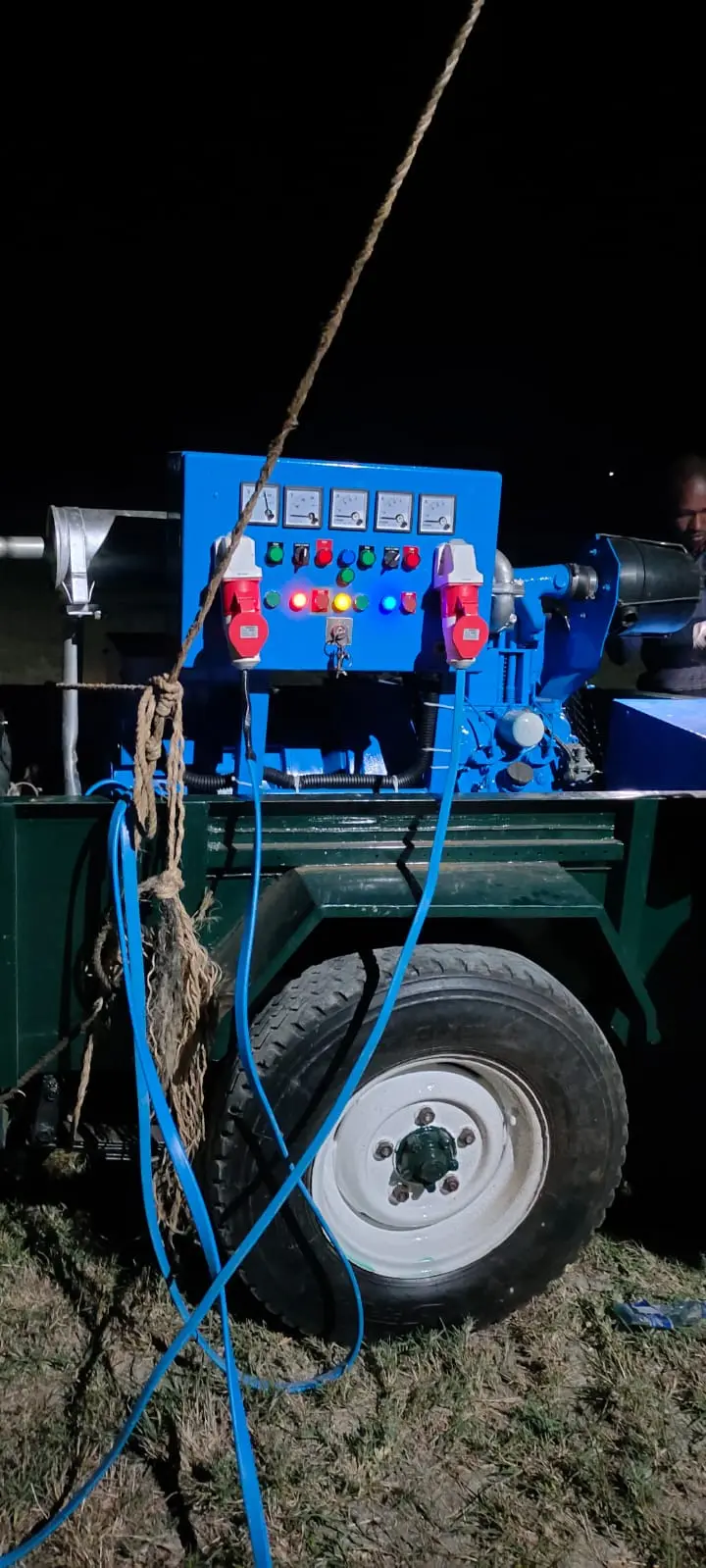
- Modern DTH drilling rigs — Our rigs are equipped with high-pressure compressors (up to 35 bar) and powerful down-the-hole hammers that can penetrate even the hardest basalts and phonolites efficiently.
- Expert well design — We design boreholes with appropriate casing, screen, and filter pack for the specific geology, ensuring long-term productivity and water quality.
- Comprehensive service — We handle everything from geological assessment and permits to drilling, pump installation, and after-sales support.
- Proven track record — Over 1,150 successful boreholes and a 98% success rate across all projects, including hundreds in Nairobi's most challenging geological settings.
Ready to drill a borehole in Nairobi? Contact WaterLink Limited for a free consultation and a detailed geophysical assessment. Our experts will help you understand your property's geology and the best approach for a successful borehole.
Nairobi's volcanic geology presents challenges, but with the right expertise and technology, it also offers excellent groundwater resources. WaterLink Limited has the knowledge, experience, and equipment to help you tap into this resource reliably and cost-effectively.